
Klosterwald GmbH is Austria’s first burial forest operated by church institutions. The company relies on mobile and centimeter-accurate GNSS GIS data to determine the exact position of individual gravesites. The technical solution for this was supplied by ppm GmbH.
More and more people want to be buried in the great outdoors, preferably in the forest. With its special atmosphere, for most people this is a place where they already felt at home during their lifetime.
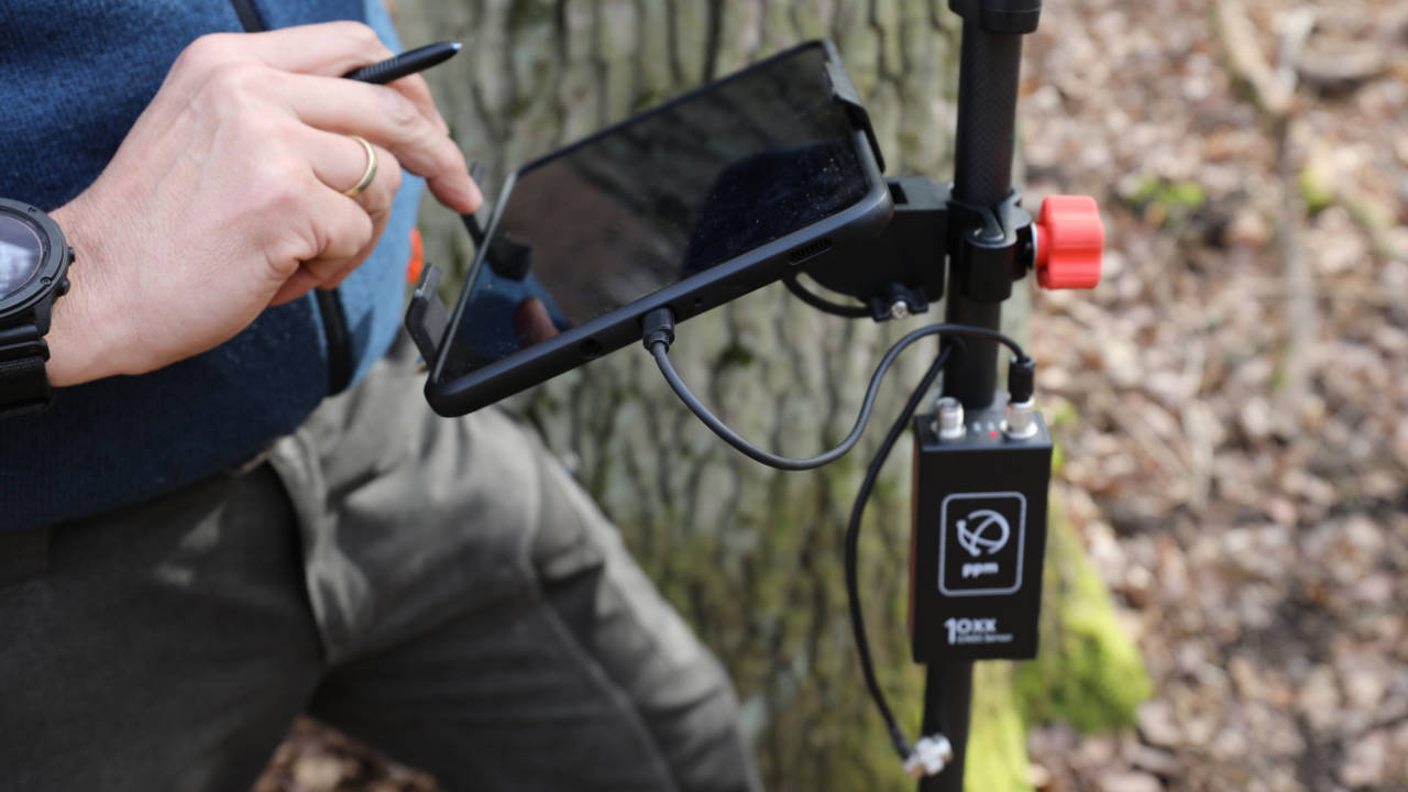
“Instead of headstones as in traditional cemeteries, there are small information boards on the trees in the burial forest, under which up to 10 urns can be buried,” explains Hubertus Kimmel. The qualified forester is one of the managing directors of Klosterwald GmbH and manages the forestry operations of Kloster Neuenburg Abbey. “We use the ppm10xx GNSS sensor so that we can record the position of the individual urn graves down to the centimeter. It is small, light and easy to operate and provides highly accurate data even under the difficult conditions in the forest.”
Accurate data even under difficult conditions
The ppm10xx GNSS sensor is a multi-frequency RTK receiver that can receive signals from several global navigation satellite systems (GNSS). These include the best-known GNSS system GPS from the USA, as well as GALILEO from Europe, GLONASS from Russia and the Chinese BEIDOU. By using several different satellite systems, the ppm10xx GNSS sensor always has sufficient signals available so that it can record precise position data even in the forest, where foliage can obscure the signal.
User-friendly and quick to use
In addition to the high level of accuracy, Hubertus Kimmel appreciates the ease of use of the device. “After a short briefing, any employee can use the device,” says the forestry manager. “Neither a surveying team nor special GIS or IT knowledge is required to use it.” The device, with its compact dimensions of just 10 x 5 x 3 centimetres, can be connected to any tablet or smartphone via a USB interface. Users can therefore work on familiar devices and do not have to get used to a new technology.
Simple integration into the user software
Via the ppm Commander interface, the data can be smoothly integrated into Klosterwald GmbH’s geodata software. There they form the basis for creating a forest map in which the various trees are registered with their species, age, size, location and other characteristics. The map enables customers who wish to make provisions, i.e. people who want to choose a burial place during their lifetime, to find a suitable tree.
By recording the position of the urn in relation to the tree, relatives can find the place where the deceased was buried at any time. Even in the rare event that the urn needs to be exhumed, exact location data is essential. At the same time, the data also serves as documentation for the authorities, who require a minimum distance of 50 centimetres between individual urn graves by law.
Surveying the area
In addition, a natural burial site is not fenced in, but is freely accessible to everyone like a normal forest. It is therefore essential to know the exact boundaries of the neighboring properties, which is not always easy in the forest. “Boundary markers in the forest are often very old and inaccurately measured,” explains Hubertus Kimmel. “We still have boundary stones here from the time when the monastery was founded in the 12th century, which are very artistically designed, but no longer meet today’s demands for accuracy. But especially with burials, it is of paramount importance that the deceased is buried in the approved territory and not accidentally on the neighboring property.”
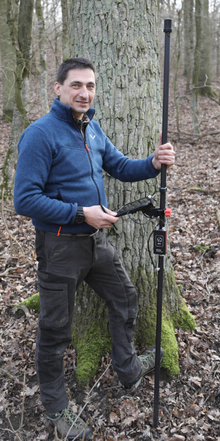
For Hubertus Kimmel, it was also important to survey and document the entire site. To do this, he took the ppm10xx GNSS sensor on his bike and cycled along paths and recorded special places such as places of worship so that they could be entered in the forest map.
An app for smartphones is being planned
Expanded use of the data is also already being planned. “We are currently considering developing an app that maps the area and guides relatives to the gravesite of their deceased,” says Kimmel. “The only challenge at the moment is the inaccuracy of cell phones in determining their position, but this will also decrease in the coming years.”
Klosterwald GmbH / klosterwald.at
The Klosterwald Verwaltungs GmbH provides forest areas of monasteries and Christian communities as burial forests and thus wants to offer an alternative to traditional forms of burial.
Photos: Kimmel