
The latest satellite technology for historic gardens
The Bayerische Schlösserverwaltung (Bavarian Palace Department) uses the ppm10xx GNSS sensor for tree management and heritage management.
The properties of the Bavarian Palace Administration include around 160,000 trees that require safety maintenance. These trees are recorded in a digital tree register for their regular maintenance and inspection, which is currently being revised using the latest satellite technology.
The digital tree register forms the basis for tree management, which includes all work related to the trees. The aim is to preserve the valuable, historical gardens and, above all, to ensure the safety of the trees – a very responsible task in view of the millions of visitors who frequent the parks throughout the year.
The ppm10xx GNSS sensor is used to capture the position of the trees when creating the tree register. The compact device can process the signals of several global satellite navigation systems (GNSS), thus ensuring highly precise measurement results.
“Even under leafy trees, the ppm10xx GNSS sensor provides position data with centimeter-level accuracy,” says Michael Degle, landscape architect at the Bavarian Palace Administration. “What’s more, the system is so easy to use that even less computer-literate gardeners can carry out all the work themselves. This saves time and money and gives us the flexibility we need in our work.”

Determining positions via satellite
An exact position is the linchpin of tree management. After the tree inspectors have determined measures for a tree, such as the removal of rotten branches, the arborists in charge must be able to reliably find the corresponding tree in the terrain. However, position detection via GNSS is particularly challenging under trees. Often, the measurement result is less accurate than in open spaces because foliage and branches interrupt the satellite signal. Experts speak of “shading” here.
The ppm10xx GNSS sensor is designed to minimize the effects of this phenomenon: the device is able to process the signals of several global satellite navigation systems, including not only GPS from the USA but also GALILEO (Europe), BEIDOU (China) and GLONASS (Russia). This means that there are always enough satellites available to determine the exact position. The flexible gooseneck antenna further improves reception by allowing it to be aligned individually.
When the tree inventory was first created between 2008 and 2017, the position was determined using the integrated GPS in the tablet, which sometimes led to extreme inaccuracy.
“With the old system, positions were sometimes located up to 20 meters from the actual tree,” Degle recalls. “With the ppm10xx GNSS, we achieve a significant improvement.”
Seamless integration of position data
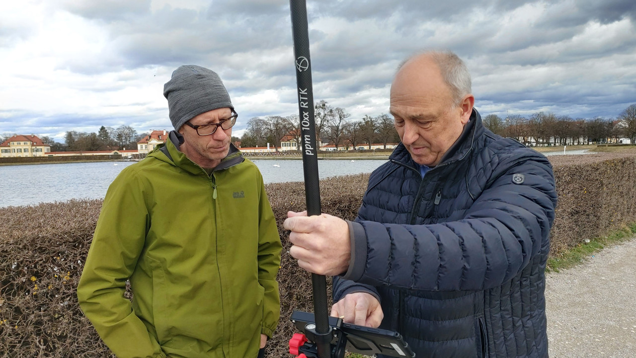
For field work, the tree inspectors attach the ppm10xx GNSS sensor to the back of their tablet using a clamp system and connect it via USB. The tablets have a large, user-friendly screen that allows for comfortable work even in outdoor lighting conditions. Once the satellites have found the position of a tree, the inspector can use the touch function in the RIWA tree control app to record this point and store any necessary maintenance measures. The sensor also allows for eccentric measurement: this allows the center of the tree to be determined even when the inspector is standing next to the tree.
All the data collected is stored in the RIWA GIS center and is therefore available centrally. The PPM Commander, a software that ensures seamless integration of GNSS data into a wide range of application programs, serves as the link between the two systems.
As soon as the arborists arrive at the site, they can also access the position of the tree and the measures to be carried out from the cloud using a tablet.
Lightweight and compact
In addition to precise positioning and flexible data management via the cloud, the compact dimensions and low weight of the GNSS sensor make work significantly easier for tree managers. With external dimensions of just 10x5x3 centimeters and a weight of 130 grams, the ppm10xx GNSS sensor is not a burden, even during long working days in the field. Depending on the application, the sensor can also be combined with an antenna rod kit. This consists of a pluggable, two-meter-long carbon rod to which a precise GNSS helix antenna is attached. This provides tree inspectors with a traditional surveying system that weighs less than a kilogram (805 g).

A wide range of possible uses
Responsibility for tree management at the Bavarian Palace Administration is currently divided between three regional competence centers in Munich, Garmisch and Bamberg. Landscape architect Degle coordinates the team of nine tree inspectors, which is made up of arborists and agricultural specialists in tree care. In addition to the revision of the existing tree registry, around 14,000 individual trees on the shores of Bavarian lakes that require safety maintenance must also be recorded. Each of the three competence centers has a ppm10xx GNSS sensor for this purpose.
But Michael Degle has yet another use for the satellite receiver.
“The device also provides us with valuable services in the preservation of historical monuments, for example in the measurement of paths and garden beds,” says Degle.
Currently, the square in front of the Amalienburg in the Nymphenburg Palace Park in Munich is to be equipped with replicas of historical benches to restore its original appearance. For the planning, it is necessary to create a survey of the site and to measure the water-bound paths. Here, too, Degle uses the ppm10xx GNSS sensor and is impressed by its performance:
“I was able to measure 700 points with the ppm10xx GNSS sensor in three hours. It would have taken us days to do this before.”
Tree management increasingly important
Whether due to extreme weather conditions, long dry spells or invasive pests – climate change is having a severe impact on native trees and thus also poses major challenges for the Bavarian Palace Administration. Should anyone come to harm from a tree, the tree owner is liable, in this case the Free State of Bavaria. With climate change on the increase, maintenance and control are absolutely essential for safety. For landscape architect Degle, however, tree management means much more than that: